June 26 - Inverness to Cromarty
It seems like the days always fit into two categories: it starts out beautiful then turns to crud, or it starts out like crud but then clears up. Of the 10 days so far, only one day has been nice for the entire day, and only one has been lousy for the entire day. Today's would be a bit different. It started out fine, then turned to crud for a couple hours, then settled down as a fairly nice day once I got over onto the Black Isle.
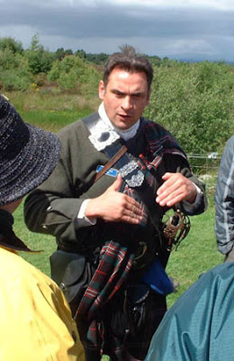
The first nice part of the day occurred while I was cycling over to Culloden to visit the battlefield. I have read that this was one of the great defining moments in the history of Scotland, so I had to go see for myself. Click here for an exhaustive study of the battle and its ramifications. After a tiring morning trying to follow the Bike Route 1 signs (Bike Route 1 has been laid out and marked by Sustrans to travel from Aberdeen to John O'Groats), I finally reached the battlefield around 10:30. I wandered around the grounds for a while, until it started to pour (what else is new??). Taking shelter in the visitor center, I discovered that a guided tour was about to start. At the last minute, I decided to join them. This was a good decision, because our guide was very knowledgeable and had a very engaging style. The rain stopped for a while, but picked up again about midway through the tour, but it was never so bad as to ruin the tour.
The Black Isle (which isn't really an Isle, it's just a peninsula) represented a dramatic change in landscape from what I had been used to over the previous week. Though it was still quite hilly, most of the hills were fertile and covered with grain fields. This made for very pleasant cycling. I didn't pay as much attention as I should have though, and missed a turn. Which I didn't discover until I crested a hill only to see the Cromarty Firth in front of me. Bummer. So I rode along the firth for longer than I had planned. It was a really nice ride, as the fierce wind became a tailwind. The firth is used as a "parking lot" for oil rigs that are not in service, and due to the worldwide oil glut, there were currently 12 rigs parked here. It was quite a sight, as these rigs are very large and just don't fit in with the scenery.
I was getting quite hungry by this time, so I stopped in at the local hotel for a bite before climbing the hill to find my B&B. Again, the food was quite tasty. And again, the rain cut loose with a fury. My bike wasn't covered while I was eating, and I found it soaked when I came out after eating. Oh well... I planned for wet conditions so nothing was ruined.
Somewhere in my research for this trip, I read about some old wartime fortifications that were built on the Sutors, a pair of hills flanking the entrance to the Cromarty Firth. I asked my hosts about them, and they pointed me to a hiking trail that started in town and took me up to the South Sutor. It was a very nice hike, rising up through hardwood forests and passing old gun emplacements. From the top I got a nice view of the town and the North Sutor. But I think I overdid it. My feet were quite sore when I got back to the B&B.


0 Comments:
Post a Comment
<< Home